The Wednesday Discovery Day included meetings around town with
specific locations and aspects of wayfinding and streetscape to be discussed.
The conversations were often broader. The summaries provided below are intended
to describe the existing conditions of various areas, provide summaries of the
discussion of those areas, and also the general things that we heard from
people. While these conversations were often repeated at the different sites,
we have provided their general content only once within these summaries.
Overlook
The overlook area is the first place where people have an
opportunity to pull over from the highway and orient on their arrival into
Homer.
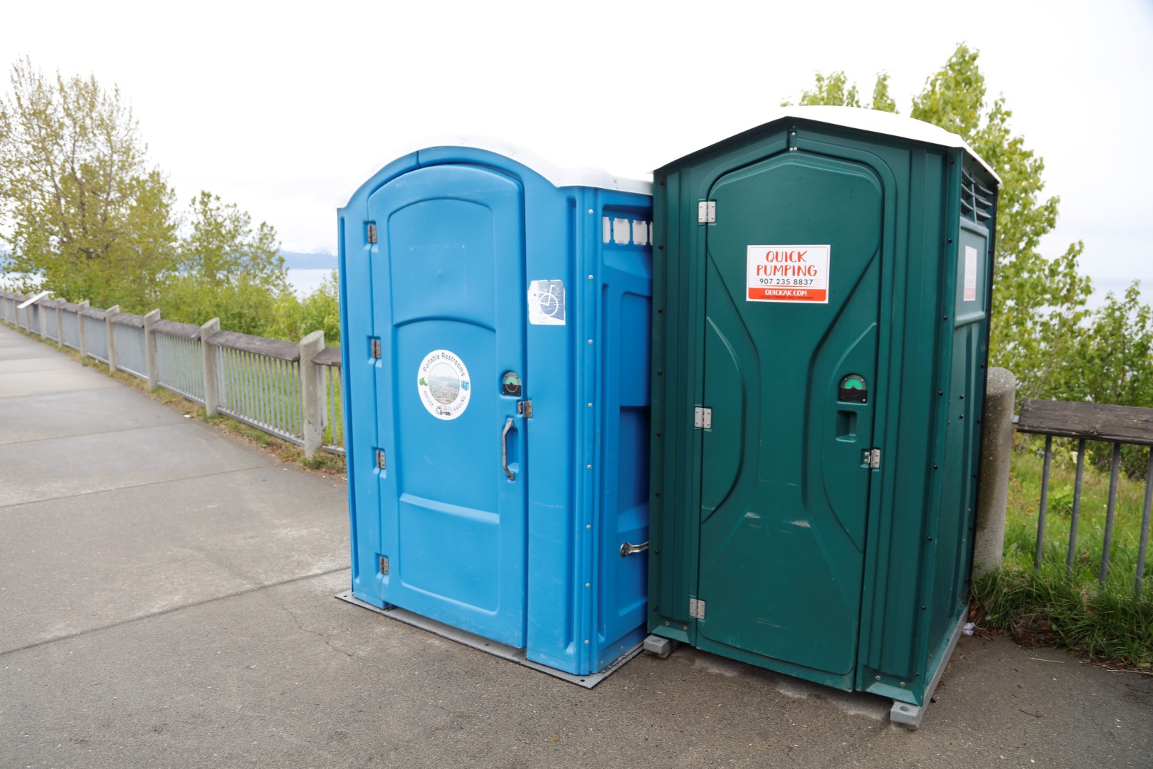
The overlook is an Alaska Department of Transportation and
Public Facilities (ADOT) wayside that the City of Homer maintains through a
memorandum of understanding with ADOT. The existing vault toilets are
condemned, with two portable toilets currently there.
At the north of the site is a simple sign with ‘welcome’ on
the top of it, with logos of fraternal organizations and the Chamber of
Commerce. At the south end of the site is a more decorative sign with ‘Homer
Alaska Halibut Fishing Capital of the World’ on it. This sign is often used for
photos.
The wayside has a concrete plaza with various planters
within it that are maintained by local groups. At the center of the plaza is a
compass rose, and an adjacent enclosed visitor information building that is run
by the Chamber of Commerce. This is a relocatable building that is located
within the plaza, between the compass rose and the bluff/view. There are a few
interpretive panels, and a number of benches. This location provides good views
across Resurrection Bay.
Overall, this location is a valuable entry to Homer where
people can stop and get information if the visitor information building is
open.
The area is used by both visitors and locals, so
improvements should be targeted at both user types. Discussion on site related
to how the area could be improved with new bathroom facilities, an open
shelter, and picnic tables. A new building could provide better facilities for
visitor information purposes, ideally located away from the views.
Wayfinding discussion related to how this wayside is not
well signed from the highway. There would be benefit in coordinating with ADOT
to provide a wayside/visitor information sign prior to the turn-off. There
would also be in having a simple ‘Homer’ sign close to the city limits on the
Sterling Highway. The side of the current (condemned) toilets has a very simple
sign with abbreviated Homer destinations. If the information building is not
open, there is no significant information here to help visitors shape their
trip. The site would benefit from City of Homer sign panels that would orient
people on Homer’s extents and general opportunities within the entire City.
These should be exterior signs, available at any time. This would hopefully
expand people’s knowledge of Homer, and clue them in better for how to access
destinations off the Sterline Highway. The City of Homer signage would provide
general information, and key civic destinations. Adjacent to this panel (or
panels), the Chamber of Commerce could provide additional information relating
to local businesses and private/public destinations. This would be in addition
to the current (or future) information building where visitors could interact
with a representative of the Chamber, or have access to other materials such as
pamphlets and rack cards.
A key wayfinding component of this site would relate to
informing RV travelers on how best to get their vehicles into, through, and
parked within the City. For all visitors, an important aspect of signage is to
help them anticipate and plan for potential concerns they might have. For Class
A motorhomes, this relates to helping drivers avoid getting their vehicles into
areas that are difficult to drive in, or more importantly, get out of.
Any other improvements to the area would provide additional
benefit as an improved destination for locals and visitors.
Airport
The airport terminal is the first place where people have an
opportunity to orient on their arrival into Homer. The land is owned by ADOT,
and the building is owned by the City of Homer and operated by ADOT. For those
where Homer is their destination, the lobby contains pamphlets and rack cards
for visitor information. Similar to the Overlook, this location would benefit
from exterior signage by the City of Homer and the Chamber of Commerce to
orient people on the City, and share its opportunities.
As the airport also connects people to and from other forms
of transportation, information should be provided top help them get to their
next mode of transportation. The connection for people from the airport
terminal to the air taxis (ground or water based) was noted as not being clear.
Wayfinding signage should help not only identify where people may need to go,
but also help them understand distances. This assists with establishing
expectations, and allowing people to choose whether they walk or use vehicular
transportation.
Boathouse
We met at this location to discuss the Homer Spit in
general.
Similar to the Overlook and the Airport, the Spit is a first
point of contact for those who might be arriving via ship and boat (ferries,
cruise ships, commercial boats/ships, and small boats). The ferry terminal and
Harbormaster’s Office would benefit from exterior signage by the City of Homer
and the Chamber of Commerce to orient people on the City, and share its
opportunities.
Vehicle and pedestrian congestion and activity, combined
with the proximity of a large variety of businesses and their signage to the
road, can make it challenging to orient within and navigate within the Homer
Spit. A key issue is the lack of parking and congestion of parking areas, and the
pressure that parking has on pedestrian and vehicle circulation. A parking
study is currently underway for the Homer Spit.
Better signs are needed to direct people to the harbor and
port facilities (Freight Dock Road). The area at the halibut hook sculpture (or
across from it) might benefit from a large vehicle-scale map of vehicle
destinations and parking.
Comments were made that many people make their way to the
Homer Spit without realizing all of the other opportunities within the City of
Homer. While wayfinding on the Homer Spit should help people navigate to
parking, and then navigate as pedestrians, it should also encourage people to
explore other parts of Homer.
The Homer Spit is served by a private shuttle/trolley
service, as well as a private bike-share service. These are good examples of
efforts to encourage people to park off the Homer Spit and explore it without
contributing to vehicle or parking congestion.
Beyond the current parking study, there is also a need for a
harbor expansion in the future. Such an expansion could help to alleviate
parking concerns, and better separate commercial and industrial activities from
small vessel activities.
The Boathouse is the most central public facility within the
commercial and small boat harbor area of the Homer Spit. The original design
for the Boathouse included a small park between the building and the
road/restroom. If parking issues can be alleviated, this area would be a good
location for exterior signage by the City of Homer and the Chamber of Commerce
to orient people on the City, and share its opportunities. A key aspect of this
is making a significant pedestrian connection between the Boathouse and the
road.
Without creating additional pedestrian space, signage would
likely be most visible if placed in front of or on the restroom walls.
The boardwalk adjacent to the harbor is an underused
amenity. While signage would assist with encouraging people to use it, better
pedestrian friendly connections to it would also encourage people to find and use
it. Ideally, with more boardwalk activity, businesses would hopefully orient
themselves on the boardwalk to add additional activity and life to that
experience. Splitting pedestrian traffic between the boardwalk and the
streetside would help with congestion.
Pioneer
We met at City Hall, and walked down Pioneer to Main Street.
In general, Pioneer is a very busy street with a design that is not conducive
to comfortable pedestrian movement. The sidewalks are narrow, conversation is
challenging due to large vehicles, many curb cuts are present for business
access, and minimal landscaping is present to define the space between the
sidewalks and the road, and sidewalks and adjacent businesses. The density of
similar businesses is also low, making it a challenge to encourage people to
park once and walk between destinations.
Pioneer Avenue is owned by ADOT, but maintained by the City
of Homer.
WKFL (Wisdom, Knowledge, Faith & Love) Park is at the
corner of Pioneer and Heath and has public toilet, a gazebo, a bench, and open
space. There is also a public toilet on the south side of the Pioneer and
Bartlett intersection. There are few locations with benches, with one being the
northeast corner of Pioneer and Main adjacent to a mural wall. The corridor
includes a number of gardens where local volunteers or adjacent businesses are
beautifying the road.
The goal that people discussed for this corridor is to
develop the streetscape in a way that it encourages people to walk. This would
include streetscape improvements to make it more comfortable to walk.
Aesthetics and landscaping will be important for this to help to ‘green’ the
experience from what is currently very urban. The other will be to provide
amenities such as benches, whether within the right of way, or more likely in
partnership with adjacent businesses to allow seating to be away from traffic.
The wayfinding component of this is to ensure that people know what to expect.
This can include times or distances between streets, and the reassurance that
there is seating. This is important for those that might have mobility
impairments where knowing there is seating allows them to see more of an area
by resting.
Beyond encouraging and helping people to comfortably visit
businesses, parking is a concern. Ideally there would be central parking
locations for a “park once and walk” strategy. Without this, agreements would
be needed among businesses to encourage people that it is okay to park at one
business, and then stay parked there to visit other businesses.
The provision of the two public toilets is a great amenity,
even more for WKFL Park as it provides a larger public area and its amenities.
In the future, expansion of the toilet building at Bartlett to include more
public space would create additional benefit for the corridor.
Conversations during the day reflected on the character of
Homer. Pioneer Avenue is a good example of how Homer’s buildings and their
signs begin to establish a feeling/aesthetic within the corridor. Visually,
there is a lot going on, and it currently ‘works’. The way this relates to
signs is that any directional signs within the corridor need to be recognizable
and not blend in with the way that ‘Homer character’ is established by the
adjacent businesses. Wayfinding signs do not necessarily need to focus on
‘Homer character’, rathe their role is to get people to destinations. As
appropriate, such signs can have character elements to them, but they primarily
have an important job to do in moving people.
Discussion during the day also reflected on the
‘neighborhoods’ that locals and visitors should frequent. Pioneer Avenue as
Homer’s ‘main street’ can be identified as a neighborhood, but it will take
time for it to develop successfully as a linear corridor. Some discussion
related to it having an ‘East Pioneer’ and ‘West Pioneer’ related to clusters
of businesses, but the goal was to have it be a complete destination street for
Homer.
Relating to streetscape elements for the corridor, benches,
bike racks, litter bins, planters, plantings, street trees, pedestrian light
fixtures, banners, picnic tables, and other amenities were discussed for how
they could not only create a better pedestrian scale and comfortable
environment, but for how they would also provide a better driving experience.
Beyond streetscape and wayfinding improvements, there was
discussion on how activities could help to encourage people to visit and walk
around. These included the possibility for a historic walking tour with the
history of buildings, and that many are still owned by original owners.
Chamber of Commerce Visitor Center
This meeting was focused on connecting people from the
Sterling Highway to Homer’s various destinations, and Old Town as the
destination in this area. The signs on the Sterling should be assessed for how
well they direct people to areas, with one example being that currently the
sign directs people to the “Homer Business District” rather than “Downtown”
which is more encouraging for visitors. Also noted was that the “Downtown Homer
Pioneer Avenue” sign (at Sterling and Pioneer) is ineffective in that it blends
in and isn’t overtly visible.
The idea of business or activity ‘neighborhoods’ further
took shape at this meeting, with discussion of the importance of identity for
areas and knowing where the heart of it is. Another way to look at this would
be to ask where you would say you’d meet someone in a particular area. With a
strong neighborhood presence, it would ideally be a public or easily accessible
destination. It would ideally also have easy parking.
 |
Figure 1: Map showing directional and notification signs along the Sterling Highway
|
Bishop’s Beach
This meeting was an open meeting without any particular
intended focus.
The idea of business or activity ‘neighborhoods’ was
developed further, identifying that the Homer Spit, Pioneer Avenue, Old Town
and Ocean Drive have emerged as destination areas for businesses and
public/civic entities. Within a wayfinding plan, these areas should be
emphasized with signage, branding, and possible gateway elements to ensure that
as people make their way down the Sterling, they are aware of the opportunities
around them.
The discussion also touched on sign designs and how a good
sign system has a functional foundation to direct people, but should also be
flexible to enhance their neighborhoods. Gateway signage is a good example of
this where a sign system is made more unique for an area, but people still
recognize it as a Homer neighborhood gateway.